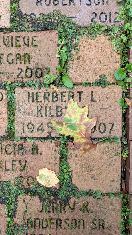
Wright State University's Place History
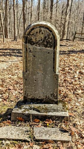
Wright State University is not a new University, but yet it has not always been here. It was established in 1967, after acquiring the property in 1964. The purchase of the property, included the Rockafield Cemetery which originated with the Rockafield family who resided there in the early 1800s. It is believed that the cemetery was established around 1825.
Martin Rockafield (1761-1836) first moved to the Bath Twp, which is located in the NW corner of Greene County, in 1807 from Maryland. Together with his wife, they had five sons: John, Aaron, George, Isaac, Jacob and one daughter, Mary. John Rockafield married Susan E. Cost, who was the daughter of John Cost, a prominent member of Greene County. It was John and Susan who owned the property where the Rockafield cemetery is located, on Wright State University land. The Rockafield cemetery was not used just by the Rockafield family, but also many of their close neighbors were buried there. It is estimated that there are approximately 45 buried in the original cemetery, and the only headstone remaining for a Rockafield family member buried there was the original matriarch of the family, Martin, who died in 1836.
Martin Rockafield (1761-1836) first moved to the Bath Twp, which is located in the NW corner of Greene County, in 1807 from Maryland. Together with his wife, they had five sons: John, Aaron, George, Isaac, Jacob and one daughter, Mary. John Rockafield married Susan E. Cost, who was the daughter of John Cost, a prominent member of Greene County. It was John and Susan who owned the property where the Rockafield cemetery is located, on Wright State University land. The Rockafield cemetery was not used just by the Rockafield family, but also many of their close neighbors were buried there. It is estimated that there are approximately 45 buried in the original cemetery, and the only headstone remaining for a Rockafield family member buried there was the original matriarch of the family, Martin, who died in 1836.
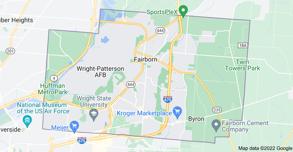
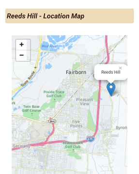 Wright State University is the
tan area to the left of SR 844
https://ohio.hometownlocator.com/maps/feature-map,ftc,1,fid,1065749,n,reeds%20hill.cfm
It was said that the first settlers who came to this area would have looked down on the valley from Reed’s Hill, which is situated on a hilltop at the present day Trebein Rd and State Route 235 in Xenia. There is a story told that some of the first settlers here, would occasionally have children come up missing and it was discovered that the Native Americans would capture them and raise them with their tribe. In turn, the early pioneers would kidnap Native American children and they would then later line up, with the settlers on one side, the natives on the other and they would exchange the children back to each other. One family, by the last name of Cozad, had lost their son and the local tribe agreed to return him after four years, but the chief of the tribe said he wanted to see where the boy lived. So, they met at the top of Reed’s Hill and they pointed ‘down there’ to indicate their homes and the chief allowed the boy to go back to his family. The chief referred to that valley as a ‘fair field’, hence the name of the village Fairfield. The location of this ‘valley’ is currently where Wright State University and Wright-Patterson Air Force Base are situated. At the time the early Rockafields owned their homestead here, the most significant presence of Native Americans were the Shawnee which had a village located at Oldtown, which was originally named Old Chillicothe. The Shawnee were a nomadic group that traveled north toward Sandusky in the summer months and back down to the Old Town in the winter. They were said in general to be a peaceful group that initially liked to trade with the early settlers, but as time progressed, they started to realize they would have to defend their land and tried to make the settlers' lives difficult so that they would want to leave their land. As we know, the Shawnee, as with all of Native Americans that called this land their home, eventually relocated west of the Mississippi River.
This story was told in the interview with John Cox “When the pioneers took up their abode in the wilds of this township, they found that red men were undisputed possessors of the forests. They represented the Delaware and Shawanoes tribes, and were generally peaceable and harmless. They devoted their time mostly to hunting and fishing, and would frequently present the whites with venison. During the cold winter months, they often came to the house of Mr. Haddox, and obtained permission to lie down by the fire-place, which they considered a great treat. John Haddox well remembers the names of two of these-Ellalaho-passewassona and Patucky-passaqua. In the spring of each year most of them left for the Sandusky reservation. Here they spent the summer months, and returned again as the cold weather approached. They decreased in number gradually, and, with their tribes, finally moved westward. In 1825 there was but one Indian family in the township. They gained a livelihood by making baskets, and trading the same for bread. Occasionally a few straggling red men passed through the country, but in a few years later every vestige of them had disappeared.” https://www.heritagepursuit.com/Greene/GreeneBathTp.htm
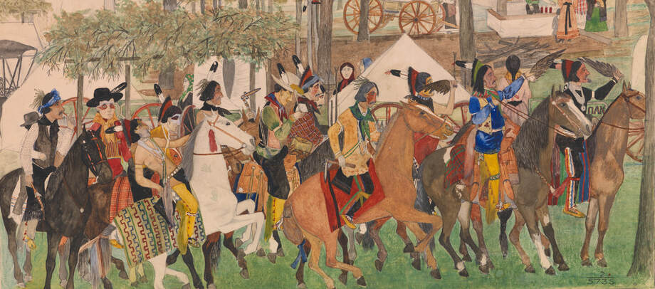 "Procession Before War Dance", Ernest Spybuck Credit: National Museum of the American Indian, Smithsonian Institution (02/5735).
This photo was borrowed from the website of the present day Absentee Shawnee tribe which now resides in Oklahoma.
The land at this time was described as being heavily forested and the first pioneers worked together to start clearing the land in order to build their homes. The village of Fairfield, which is the oldest village in Bath Twp, was bordered on the west by the Mad River, and on the east by the ridgeline named Reed’s Hill. Reed’s Hill was named for the family of one Andrew Reed, who was the first justice of the peace, and school teacher at one of the first schools. Reed later became elected judge of the Court of Common Pleas Greene County.
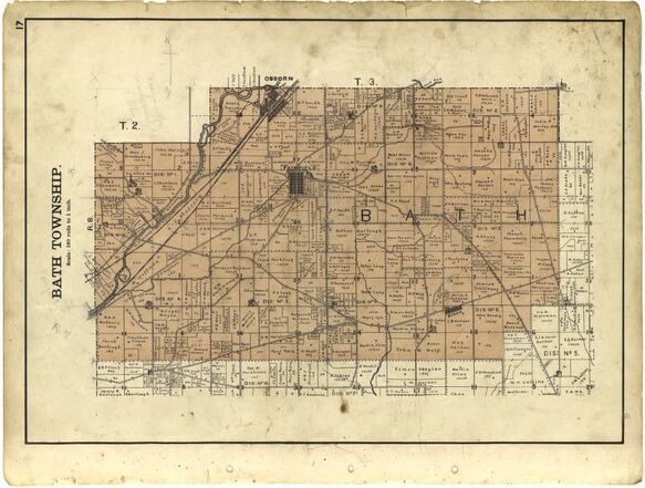
Other important family names also lived on the land which is now considered to be Wright State University. George Warner, whose childhood homes, the Warner house and the Brumbaugh house, were located on current WSU property. Koogler, Casad (Elizabeth Rockafield), Cost (Susan Rockafield), Kauffman and Zink which are recognized by important thoroughfares in neighboring communities. The Koogler family owned a cabin to the east of the Rockafield property (which was still in existence at the time of the first campus president, Brage Golding 1966-1973). The Koogler cabin was situated on a wagon trail that ran east of the cemetery and the President’s house. According to the research done on the property at the time, three owners who lived nearby, Joe Koogler, George Warner and Frank Zink, remember seeing gliders fly over as the Wright Brothers were testing some of their earlier experiments from the Huffman Prairie. Zink Rd, where most campus housing is located, carrying the Zink family name. See map below, of Bath Twp in 1855.
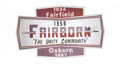 https://www.fairborndailyherald.com/top-stories/39643/the-tale-of-two-villages-how-fairborn-was-born
During the time of when the Rockafield family lived on the property, there were still Native Americans living here, although not as prevalent as before Ohio was colonized. By 1842, the remaining of the tribes living in Ohio (the Wyandot) were last seen here before being relocated out west. Travel was done by horse or wagon, the railroads were just starting to be laid out across the country, and the Great Flood of 1913 had not happened.
In 1850, a second village was established to the northwest of the village of Fairfield, and it was called Osborn (named after the Superintendent of the railroad that was being laid down through the area). Osborn was situated close to the Mad River and grew steadily, partly due to the fact that there was no longer a presence of Native Americans in the area. However, nature taking its own course, the Great Flood of 1913 occurred and the village of Osborn realized that it would have to move or continue to face destruction with similar catastrophic results again in the future. Dams were also being built in order to help maintain the Great Miami River and the Mad River. In 1921, it was decided to move the village to the east of Fairfield. This worked fine for a few years, but after a while, the village of Fairfield was expanding and with Osborn on its outskirts , there was nowhere for it to expand. It was this decision that resulted in the merger of the two villages into the city of Fairborn, 1949.
In 1850, a second village was established to the northwest of the village of Fairfield, and it was called Osborn (named after the Superintendent of the railroad that was being laid down through the area). Osborn was situated close to the Mad River and grew steadily, partly due to the fact that there was no longer a presence of Native Americans in the area. However, nature taking its own course, the Great Flood of 1913 occurred and the village of Osborn realized that it would have to move or continue to face destruction with similar catastrophic results again in the future. Dams were also being built in order to help maintain the Great Miami River and the Mad River. In 1921, it was decided to move the village to the east of Fairfield. This worked fine for a few years, but after a while, the village of Fairfield was expanding and with Osborn on its outskirts , there was nowhere for it to expand. It was this decision that resulted in the merger of the two villages into the city of Fairborn, 1949.
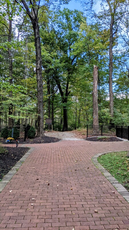
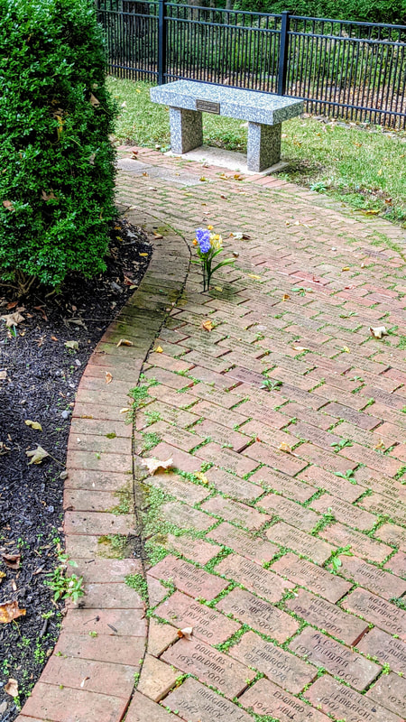
After Wright State University was founded in 1967, it later also established the Boonshoft School of Medicine in 1973. It was the Boonshoft School of Medicine that developed the anatomical gift program in 1980, and the Rockafield Cemetery was developed for the donors. The Rockafield Cemetery was built beside the original cemetery of the Rockafield family, an extension of the sacred place from the early 1800s. If you get a chance to visit our campus, you can find both cemeteries on University Blvd., Fairborn, Ohio.
(click on individual photos to see full images)
Resources:
Rockafield Papers, Dunbar Public Library Archives, Wright State University
Reeds Hill Map:
https://ohio.hometownlocator.com/maps/feature-map,ftc,1,fid,1065749,n,reeds%20hill.cfm
Map of Bath Twp 1855:
https://www.loc.gov/resource/g4083gm.gla00146/?sp=20&r=0.223,0.177,0.284,0.608,270
https://www.heritagepursuit.com/Greene/GreeneIndex.htm (whole article)
https://www.heritagepursuit.com/Greene/GreeneBathTp.htm (specific to Bath Twp)
https://www.wrightpattersonhousing.com/history
https://www.astribe.com/ (Shawnee tribe painting)
"Procession Before War Dance", Ernest Spybuck Credit: National Museum of the American Indian, Smithsonian Institution (02/5735).
https://www.fairborndailyherald.com/top-stories/39643/the-tale-of-two-villages-how-fairborn-was-born (image of Fairfield/Osborn merger into Fairborn)
https://medicine.wright.edu/sites/medicine.wright.edu/files/uploads/0/article/agp.pdf
https://www.wright.edu/about/wright-state-history#:~:text=The%20campus%20opened%20in%20September,university%20contingent%20upon%20enrollment%20totals.
https://medicine.wright.edu/sites/medicine.wright.edu/files/page/attachments/Rockafieldmap.pdf
